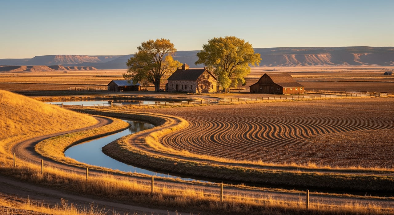
Selling irrigated acreage around Olathe can feel complex, especially when water, maps, and disclosures enter the picture. You want a smooth sale and confident buyers, but it is hard to know which records matter and where to find them. This guide shows you exactly which irrigation maps and water documents to gather, why they matter, and how to disclose them clearly. Let’s dive in.
How Olathe irrigation works
Most irrigated parcels around Olathe receive water through the Uncompahgre Valley network operated by the Uncompahgre Valley Water Users Association (UVWUA). UVWUA maintains customer accounts and delivery records that show when and how much water has been delivered. You should pull your account history to document recent deliveries and confirm any assessments or balances. The UVWUA Customer Information Portal is the best place to start for billing and delivery data and account details (UVWUA CIP).
Legal water rights are recorded and administered by the Colorado Division of Water Resources (DWR). That record shows the decreed right, priority date, and point of diversion. Many streams in Water Division 4 (Gunnison Basin) are noted as over‑appropriated, which can affect junior rights in dry years. Use DWR resources to verify your rights and administration context (DWR Division 4 office).
Map your acreage
A clear map set helps buyers see canals, laterals, drains, and easements that touch your land.
- Use the Montrose County parcel viewer for parcels, aerial imagery, and overlays that help you spot ditches and access points (Montrose County Interactive Maps).
- Mark visible canals, laterals, headgates, and any private ditches that cross or serve your property.
- If you have historic Uncompahgre Project maps or surveys, include them. Historic project maps can help explain original canal alignments and project lands.
Required water disclosures in Colorado
Colorado expects clear, written disclosures about water on land sales. Plan to complete these early.
Seller’s Property Disclosure (Land)
Complete the Commission‑approved Seller’s Property Disclosure (Land) and attach water documents such as well permits or shared‑well agreements. The current fillable form is available from the Division of Real Estate (SPD19L form). Answer to your current actual knowledge and include supporting paperwork.
Statutory source‑of‑water disclosure
Colorado law requires disclosure of the potable water source in your contract and disclosures. If a well serves the property, include the well permit if available. You can review the statute for details on what must be stated (Colorado source‑of‑water statute).
Build your irrigation “water packet”
Create a single packet that answers the two questions buyers always ask: do water rights exist on paper, and has water actually been delivered?
- UVWUA account history. Export billing and delivery history showing acre‑feet delivered and turn‑on/turn‑off dates. Confirm assessments are current (UVWUA CIP).
- UVWUA assessments or lien status. If there are unpaid charges, UVWUA may pursue property liens. Check your account and review association forms and notices (UVWUA forms and notices).
- Deeds, share paperwork, and easements. Gather share certificates and deed language that describe appurtenant water or any releases or transfers. Pull recorded deeds and ditch easements from the county records (Montrose Clerk & Recorder online search).
- DWR water‑rights report. Print the relevant Structure Search or Water Rights report for your surface diversion and download well permit and drilling logs if a well exists (DWR data tools).
- Parcel and ditch maps. Include a county parcel map or survey that shows canals, laterals, drains, and any recorded encumbrances (Montrose County Interactive Maps).
- Completed SPD19L. Include the filled SPD19L with water attachments so buyers have the full story upfront (SPD19L form).
Put this packet in your listing documents and have printed copies available at showings. It speeds due diligence and builds buyer confidence.
How to read a DWR record
When you share a DWR report, point buyers to the key lines:
- Priority date. Senior rights are generally more reliable in shortages.
- Decreed amount. Look for cfs or acre‑feet and the type of use.
- Point of diversion and place of use. Confirm they match your parcel and delivery point.
- Status. Note if rights are absolute or conditional and whether structures are active in recent accounting. Access search tools and downloadable reports here (DWR data tools).
Red flags to fix early
Address these items before you list to avoid delays.
- Unpaid UVWUA assessments or account issues. Confirm balances and resolve early. UVWUA publishes assessment and lien information (UVWUA forms and notices).
- Missing well permit or unclear shared‑well terms. Pull the well permit and any agreements from DWR and attach them to the SPD (DWR data tools).
- Recorded canal or lateral easements you have not disclosed. Search the county index for easements across the parcel and disclose on the SPD (Montrose Clerk & Recorder online search).
- Water rights with no recent use. DWR publishes decennial abandonment lists, so document recent use and consult Division 4 if needed (DWR decennial abandonment list overview).
- Severed or released project shares. If UVWUA shares were transferred or released, gather the recorded history so buyers understand current status.
Contract and closing tips
- Be explicit about what water is included. Reference the DWR decree, share certificates, and UVWUA account number in your contract documents.
- Include current UVWUA statements. Provide the latest billing and delivery printouts so the buyer can plan irrigations and understand assessments (UVWUA CIP).
- Clarify potable water. Use the statutory source‑of‑water disclosure and attach the well permit if applicable (Colorado source‑of‑water statute).
- For larger holdings in the Uncompahgre Project, ask your advisors about any federal Reclamation reporting or acreage limits that could apply to project lands.
If you want a second set of eyes on your water packet, our team works with these documents every week in Montrose County and can help you prepare a clean, complete file for buyers. Reach out to Team Colorado Living to get started.
FAQs
What is UVWUA and why does it matter when selling Olathe acreage?
- UVWUA operates the Uncompahgre Valley irrigation network and maintains customer accounts; your UVWUA billing and delivery history helps buyers verify recent water deliveries and any assessments (UVWUA CIP).
How do I prove irrigation water transfers with my Olathe land?
- Provide deed language describing appurtenant water, share certificates, and any recorded transfers or releases, and include UVWUA account details; pull recorded documents from the county index (Montrose Clerk & Recorder online search).
Which maps should I include with my listing?
- Share a county parcel map with aerials showing canals, laterals, drains, and any visible headgates; the county viewer is the fastest way to build this packet (Montrose County Interactive Maps).
What water disclosures are required in Colorado land sales?
Are Gunnison Basin streams over‑appropriated and could that affect my buyer?
- Many Division 4 streams are administered as over‑appropriated, so junior rights can face curtailments in dry years; share the DWR report and consult the Division 4 office for context (DWR Division 4 office).